LAW ENFORCEMENT
& PUBLIC SAFETY
UAS Training, Analytics, and Edge AI for Search, Incident Support, and Investigations
Build disciplined UAS programs that deliver measurable outcomes, integrate with existing systems, and stand up to public scrutiny.
The Challenge
Public safety UAS programs face pressure from every direction
Demonstrate value to leadership, maintain standards that satisfy community oversight, and
deliver results under time pressure with limited resources.

UAS programs must prove ROI and justify continued investment
Training depends on limited instructors, aircraft, and range availability
Evidence and situational awareness must integrate with RTCC, CAD, and case management systemsc
Operations span urban canyons, rural terrain, wildfire smoke, and low-light conditionsc
Multi-agency coordination requires interoperable systems and common operating pictures
Community trust requires transparent governance, auditable operations, and clear policies
How SensorOps Helps
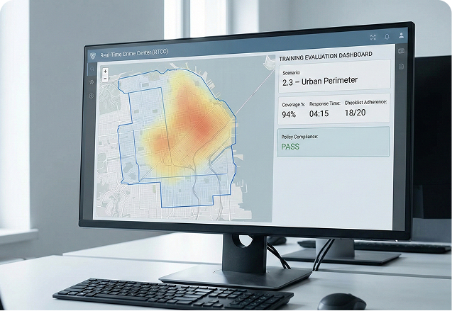
SynDOJO – Scenario-Based UAS Training
Build search, perimeter, and pursuit scenarios using local streetscapes and terrain. Train teams on airspace rules, deconfliction, communications discipline, and sensor employment under realistic time pressure. Grade coverage, response time, coordination, and adherence to agency policies. Generate repeatable training records for certification and recertification.
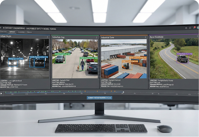
TargetModeler – Environment-Matched Datasets
Generate EO/IR datasets showing vehicles, persons, and scenes that match local jurisdiction conditions: urban, suburban, industrial, rural, and wildland. Include low-light, cluttered, and partial-occlusion cases difficult to capture consistently in the field. Provide labeled data to train and tune detection models for search, traffic operations, or scene monitoring.

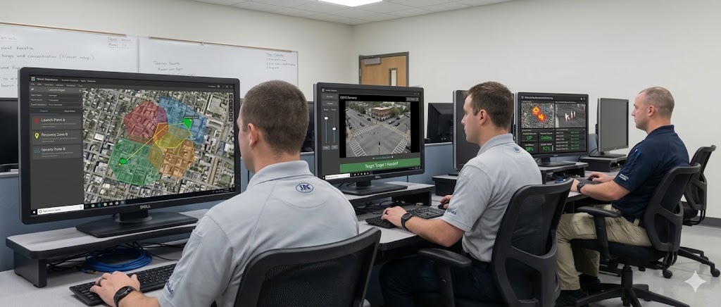
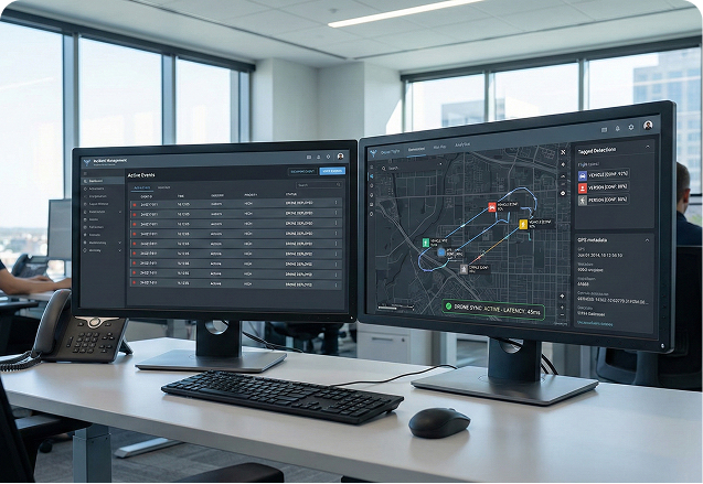
TacOS – Edge Analytics for RTCC and Field Units
Run analytics on mobile command vehicles, RTCC edge servers, or onboard UAS compute. Publish alerts and tracks into TAK, mapping tools, or RTCC dashboards as events unfold. Continue operation in degraded communications environments with derived data synced when connectivity returns.

Use Cases
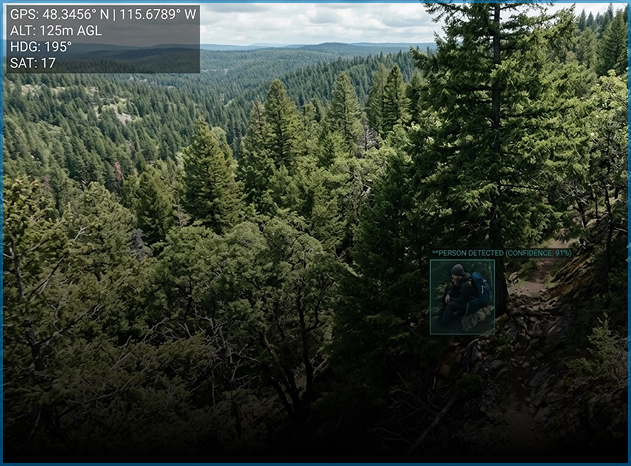
Search and Rescue
Rapid area coverage with automated detection of persons, vehicles, and heat signatures
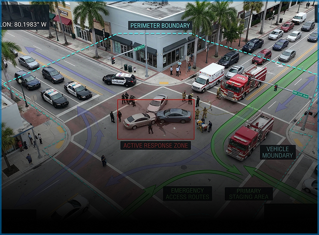
Incident Support
Real-time situational awareness for active scenes, perimeters, and traffic management
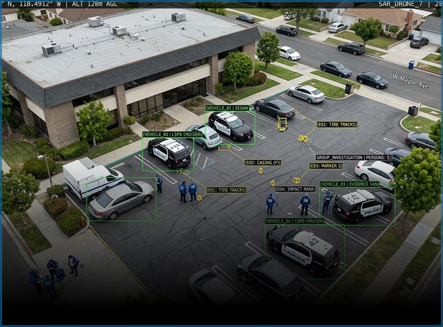
Investigations
Evidence capture with documented chain of custody and integration with case files
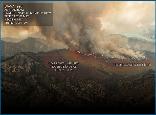
Wildfire and Disaster Response
Operations in smoke, low visibility, and communications-challenged environments
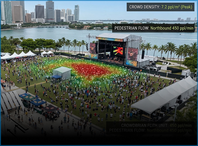
Event Security
Crowd monitoring, perimeter coverage, and multi-agency coordination
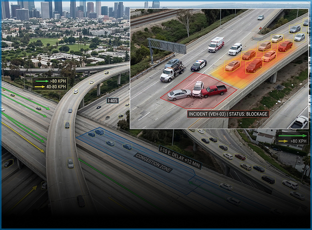
Traffic Operations
Crash reconstruction, pursuit support, and congestion monitoring
Why SensorOps?
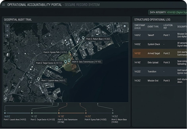
Audit-ready operations
Every training session, detection, and operator action logged with timestamps and exportable records
Local environment tuning
Models trained on conditions that match the jurisdiction, not generic datasets
System integration
Outputs flow into TAK, RTCC, CAD, and mapping tools already in use
Offline-capable
Continues operating in remote areas, disaster zones, and communications dead spots
Repeatable training
Scenario-based certification that scales across shifts and agencies without burning flight hours
No vendor lock-in
Works with standard model formats and existing hardware investments
Program Impact
Training
Scenario-based, graded, and repeatable across operators and teams without range dependency
Detection
Models tuned to local lighting, clutter, terrain, and operational conditions
Integration
Analytics connected to existing RTCC, CAD, and mapping systems instead of operating as a silo
Accountability
Auditable records that support oversight, community trust, and legal proceedings